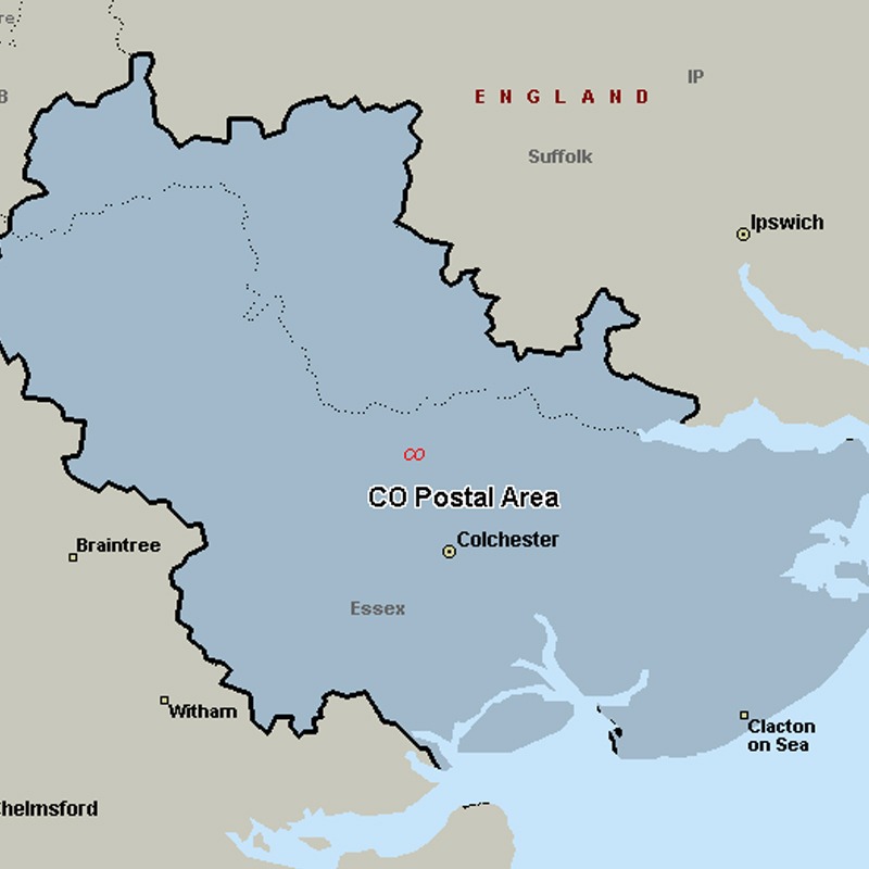
Leaflet Distribution Colchester
Leaflet Network
The CO postcode area, also known as the Colchester postcode area, covers northeast Essex (including Colchester, Bures, Clacton-on-Sea, Frinton-on-Sea, Halstead, Harwich, Manningtree and Walton-on-the-Naze) and a small part of south Suffolk (including Sudbury). The main sorting office is in Colchester.
Approximate total number of households in area: 169648
Get in touch with the team directly to arrange the leaflet distribution with them, or alternatively, get in touch with the leaflet network team to arrange this distribution for you. To come through the leaflet network there may be an added fee, but we will make sure to get every angle covered for you. For general enquiries please use the contact page.

| Postcode Sector | Households |
|---|---|
| CO1 1 | 2361 |
| CO1 2 | 4501 |
| CO10 0 | 5012 |
| CO10 1 | 3176 |
| CO10 2 | 2139 |
| CO10 5 | 970 |
| CO10 7 | 2633 |
| CO10 8 | 2412 |
| CO10 9 | 2926 |
| CO11 1 | 2451 |
| CO11 2 | 3062 |
| CO12 3 | 3062 |
| CO12 4 | 4792 |
| CO12 5 | 1428 |
| CO13 0 | 3796 |
| CO13 9 | 2318 |
| CO14 8 | 3387 |
| CO15 1 | 3022 |
| CO15 2 | 3610 |
| CO15 3 | 3997 |
| CO15 4 | 3990 |
| CO15 5 | 3547 |
| CO15 6 | 2475 |
| CO16 0 | 1124 |
| CO16 7 | 2127 |
| CO16 8 | 4896 |
| CO16 9 | 2350 |
| CO2 0 | 1842 |
| CO2 7 | 2911 |
| CO2 8 | 4425 |
| CO2 9 | 3037 |
| CO3 0 | 3245 |
| CO3 3 | 3026 |
| CO3 4 | 2948 |
| CO3 8 | 258 |
| CO3 9 | 2116 |
| CO4 0 | 3081 |
| CO4 3 | 6350 |
| CO4 5 | 3829 |
| CO4 9 | 3177 |
| CO5 0 | 3663 |
| CO5 7 | 1780 |
| CO5 8 | 3438 |
| CO5 9 | 2472 |
| CO6 1 | 4004 |
| CO6 2 | 2447 |
| CO6 3 | 2376 |
| CO6 4 | 2348 |
| CO6 5 | 267 |
| CO7 0 | 3612 |
| CO7 6 | 2496 |
| CO7 7 | 2173 |
| CO7 8 | 2355 |
| CO7 9 | 3262 |
| CO8 5 | 963 |
| CO9 1 | 3682 |
| CO9 2 | 2623 |
| CO9 3 | 2268 |
| CO9 4 | 1610 |
